There's something magical about treasure hunts that captivates both children and adults alike. The thrill of following clues, deciphering maps, and discovering hidden treasures taps into our deepest sense of adventure and exploration. In today's digital age, creating professional-looking treasure maps and scavenger hunts has become easier than ever, thanks to online mapping tools and creative applications that put the power of cartography right at your fingertips.
The Art of Modern Treasure Map Making
Gone are the days when creating a treasure map meant hand-drawing crude sketches on paper and hoping participants could decipher your artistic attempts. Today's treasure hunt organizers have access to sophisticated mapping tools that can create detailed, accurate, and visually stunning maps that enhance the entire adventure experience.
Digital mapping tools allow you to incorporate real locations, satellite imagery, street views, and custom markers while maintaining the mystique and excitement of traditional treasure hunting. You can blend the precision of modern GPS technology with the romance of old-world exploration, creating experiences that are both functional and fantastical.
Complete Tutorial: Creating Treasure Maps with Google My Maps and Canva
Creating professional-looking treasure maps has never been easier thanks to the powerful combination of Google My Maps and Canva. This step-by-step tutorial will guide you through the entire process, from creating your basic map in Google My Maps to enhancing it with artistic elements in Canva for a truly magical treasure hunting experience.
Part 1: Getting Started with Google My Maps
Setting Up Your Account
Before you begin, you'll need a Google account to access Google My Maps. Navigate to mymaps.google.com and sign in with your Google credentials. Google My Maps is completely free and integrates seamlessly with other Google services.
Creating Your First Map
Step 1: Create a New Map
- Click "Create a New Map" on the Google My Maps homepage
- You'll see an untitled map with a search bar and toolbar on the left
- Click "Untitled map" at the top left to give your treasure hunt a name
- Add a description that explains the hunt's theme or purpose
Step 2: Setting Your Base Location
- Use the search bar to navigate to your treasure hunt area
- You can search by address, landmark, or general location
- Zoom to the appropriate level – close enough to show detail but wide enough to encompass your entire hunt area
- The zoom level you choose here will be the default view when others open your map
Adding Locations and Markers
Step 3: Adding Your First Treasure Location
- Click the marker icon (looks like an upside-down teardrop) in the toolbar
- Click anywhere on the map where you want to place a treasure location
- A popup window will appear where you can:
- Add a title for this location
- Write a description or clue
- Add photos by clicking the camera icon
- Change the marker color and icon
Step 4: Customizing Markers
- Click on any placed marker to edit it
- Choose from different marker colors to represent different types of clues
- Select custom icons (flag, star, treasure chest, etc.) to make locations more visually distinct
- Use consistent color coding – for example, red for start points, yellow for intermediate clues, green for final treasures
Step 5: Adding Rich Content to Locations
- Upload photos of the actual location to help participants identify the correct spot
- Include detailed descriptions with clues, riddles, or instructions
- Add historical information or fun facts about locations to enhance the educational value
- Use formatting options (bold, italic, links) to make descriptions more engaging

Creating Multiple Layers
Step 6: Organizing with Layers
- Click "Add layer" to create separate categories of information
- Use different layers for:
- Different difficulty levels (beginner, intermediate, advanced)
- Different teams or groups
- Different types of clues (photo challenges, riddles, physical tasks)
- Bonus locations or optional challenges
Step 7: Managing Layer Visibility
- Toggle layer visibility on and off using the eye icon next to each layer
- This feature is invaluable for creating different versions of the same hunt
- You can share different layer combinations with different groups
Drawing Routes and Areas
Step 8: Adding Lines and Shapes
- Use the line tool to draw recommended routes between locations
- Create polygons to highlight specific areas or boundaries
- Add circles to indicate search areas around general locations
- Use different colors and line styles to convey different types of information
Step 9: Route Planning
- Click "Add directions" to create turn-by-turn routes between locations
- Choose walking, driving, or cycling directions based on your hunt type
- This feature is particularly useful for longer hunts or when participants need specific routing
Advanced Features
Step 10: Importing Data
- Import locations from spreadsheets (CSV files) for large-scale hunts
- Upload KML files from other mapping applications
- Use GPS coordinates for precise location placement
Step 11: Collaborative Editing
- Share editing access with co-organizers
- Multiple people can add locations and information simultaneously
- Use the sharing settings to control who can view versus edit your map
Part 2: Sharing and Accessing Your Map
Setting Sharing Permissions
Step 12: Configuring Access
- Click "Share" to set visibility options
- Choose from:
- Private (only you can see it)
- Anyone with the link can view
- Public (searchable on the web)
- For treasure hunts, "Anyone with the link" usually provides the right balance of accessibility and privacy
Step 13: Generating Shareable Links
- Copy the sharing link to distribute to participants
- Create QR codes linking to your map for easy mobile access
- The link works on both desktop computers and mobile devices
Mobile Access and Offline Use
Step 14: Mobile Optimization
- Google My Maps works excellently on smartphones and tablets
- Participants can access your map through web browsers or the Google My Maps app
- The mobile interface includes GPS functionality for real-time location tracking
Step 15: Preparing for Offline Use
- While Google My Maps requires internet connectivity, you can prepare for areas with poor signal
- Take screenshots of key map sections as backup
- Note important coordinates and addresses separately
Part 3: Enhancing Your Map with Canva
While Google My Maps creates functional, detailed maps, Canva allows you to add artistic flair and thematic elements that transform your treasure hunt into a truly immersive experience.
Exporting Your Google My Maps
Step 16: Taking Screenshots
- Use your computer's screenshot function to capture your completed Google My Maps
- Take multiple screenshots at different zoom levels
- Capture individual location details and the overall map view
- Save screenshots in high resolution for best quality when editing
Step 17: Preparing Files for Canva
- Save screenshots as PNG or JPEG files
- Organize files in folders by map section or zoom level
- Consider the final output size when choosing screenshot dimensions
Getting Started with Canva
Step 18: Setting Up Your Canva Project
- Go to canva.com and create a free account
- Choose "Custom dimensions" to match your intended output size
- Common sizes include:
- 8.5" x 11" for printable maps
- 1920 x 1080 pixels for digital sharing
- Square formats for social media sharing
Step 19: Uploading Your Map Screenshots
- Click "Uploads" in the Canva sidebar
- Upload your Google My Maps screenshots
- Drag and drop your base map image onto the Canva canvas
Adding Artistic Elements
Step 20: Choosing a Theme Canva offers numerous elements perfect for treasure maps:
-
Pirate Theme: Compass roses, skull and crossbones, treasure chests, sailing ships, weathered parchment backgrounds
-
Adventure Theme: Mountain peaks, forest elements, camping gear, hiking boots, binoculars
-
Fantasy Theme: Dragons, castles, magical creatures, mystical symbols, enchanted forests
-
Modern Urban: City skylines, street art elements, modern icons, contemporary color schemes
Step 21: Adding Background Effects
- Use Canva's background options to give your map an aged, weathered look
- Apply parchment or old paper textures
- Add subtle gradients or color overlays
- Experiment with transparency effects to blend digital and artistic elements
Step 22: Incorporating Decorative Elements
- Add compass roses in corners or along borders
- Include decorative frames around the entire map
- Insert themed icons at treasure locations
- Use arrows and banners to highlight important routes or areas
Step 23: Enhancing Typography
- Replace plain text with stylized fonts that match your theme
- Add location names using decorative lettering
- Create eye-catching titles and headers
- Use text effects like shadows, outlines, or gradients

Advanced Canva Techniques
Step 24: Layering and Composition
- Use multiple layers to build complex visual compositions
- Adjust transparency levels to blend elements naturally
- Experiment with blending modes for artistic effects
- Group related elements for easier editing
Step 25: Color Coordination
- Use Canva's color palette tools to ensure consistent theming
- Apply color filters to screenshots to match your artistic vision
- Create custom color schemes that enhance readability while maintaining aesthetics
Step 26: Adding Interactive Elements
- Include QR codes that link back to the interactive Google My Maps
- Add space for participants to make notes or check off completed locations
- Create tear-off sections with emergency contact information
- Design areas for stamps or stickers to mark progress
Creating Multiple Versions
Step 27: Team-Specific Maps
- Create different colored versions for different teams
- Add team names or logos using Canva's text and graphics tools
- Modify marker colors and route highlights for team identification
Step 28: Difficulty Variations
- Create simplified versions for younger participants
- Add more complex visual puzzles for advanced hunters
- Include bonus visual elements that provide additional clues
Finalizing and Exporting
Step 29: Quality Control
- Zoom in to check text readability at actual print size
- Ensure all important map details remain visible after artistic enhancements
- Verify that decorative elements don't obscure essential information
- Test color combinations for accessibility and contrast
Step 30: Export Options
- Download as high-resolution PDF for professional printing
- Export as PNG for digital sharing and display
- Create lower-resolution versions for email distribution or mobile viewing
- Consider creating both color and black-and-white versions
Combining Digital and Physical Elements
Creating Hybrid Experiences
Best of Both Worlds Your enhanced Canva map serves as a beautiful physical artifact that participants can hold and reference, while the original Google My Maps provides real-time navigation and interactive features. Consider these integration strategies:
- Print the Canva-enhanced map as the primary treasure hunting document
- Include QR codes linking to the interactive Google My Maps version
- Use the physical map for clues and riddles, the digital map for navigation
- Create checkpoint systems where participants verify locations using both maps
Distribution Strategies
Physical Distribution
- Print on high-quality paper or cardstock for durability
- Consider lamination for outdoor use
- Roll maps in decorative tubes for dramatic presentation
- Include additional materials like compasses or magnifying glasses
Digital Distribution
- Share both the interactive Google My Maps link and downloadable Canva PDF
- Create social media teasers using sections of your enhanced map
- Develop email templates that combine both map versions
- Build simple websites showcasing both the functional and artistic versions
Troubleshooting Common Issues
Google My Maps Problems
-
Markers not appearing: Check layer visibility and zoom level
-
Sharing issues: Verify sharing permissions are set correctly
-
Mobile access problems: Ensure participants have the correct link format
-
Slow loading: Reduce the number of high-resolution images attached to markers
Canva Enhancement Issues
-
Text readability: Increase contrast between text and background elements
-
File size concerns: Balance image quality with file size for easy sharing
-
Print quality: Use high-resolution exports and test print small sections first
-
Element alignment: Use Canva's alignment tools for professional-looking layouts
Advanced Tips and Tricks
Professional Presentation Techniques
- Create matching materials like instruction sheets, team badges, and completion certificates using Canva
- Develop social media templates for participants to share their experiences
- Design follow-up materials like photo collage templates or achievement badges
Scalability Considerations
- Template your design process for creating multiple hunts efficiently
- Develop reusable element libraries in Canva for consistent branding
- Create modular Google My Maps templates for different types of locations
Seasonal and Event Adaptations
- Modify color schemes and decorative elements for holidays or special occasions
- Create weather-specific versions with indoor alternatives
- Develop themed variations for different age groups or interests
The combination of Google My Maps' functional capabilities with Canva's artistic enhancement tools creates treasure hunting experiences that are both practically useful and visually stunning. This powerful workflow allows you to create professional-quality materials regardless of your technical or artistic background.
Start with simple projects to familiarize yourself with both platforms, then gradually experiment with more complex themes and interactive elements. The time invested in learning these tools pays dividends in creating memorable, engaging experiences that participants will treasure long after the hunt is complete.
Remember that the best treasure maps balance functionality with fantasy – they must work as navigation tools while inspiring the sense of adventure that makes treasure hunting magical. With Google My Maps handling the practical elements and Canva providing the artistic magic, you have everything needed to create truly exceptional treasure hunting adventures.
Essential Digital Tools for Map Creation
Google My Maps
Google My Maps stands out as one of the most accessible and powerful tools for creating custom treasure hunt maps. This free platform allows you to create detailed, shareable maps with multiple layers, custom markers, and personal annotations. You can import your own images, add descriptions to locations, and even share maps collaboratively with other organizers.
The interface is intuitive enough for beginners while offering advanced features for more complex hunts. You can customize marker colors and icons to represent different types of clues, create distinct layers for different teams or stages of the hunt, and embed additional media like photos or videos at specific locations.
Mobile Apps for On-the-Go Creation
Several smartphone apps have revolutionized treasure hunt creation by allowing organizers to scout locations, photograph clue spots, and create maps directly from the field. Apps like Actionbound, Geocaching, and various AR-enabled platforms let you create interactive experiences that participants can access through their own devices.
These mobile solutions are particularly valuable for urban treasure hunts where participants might need real-time navigation, location verification, or multimedia clues that traditional paper maps cannot provide.
Planning Your Treasure Hunt Route
Location Scouting and Safety Considerations
Before diving into map creation, thorough location scouting is essential. Walk through your intended route during different times of day to understand lighting conditions, foot traffic patterns, and potential safety concerns. Consider accessibility for all participants, including those with mobility challenges, and ensure all locations are publicly accessible or that you have proper permissions for private areas.
Document each potential clue location with photos from multiple angles, noting distinctive landmarks that will help participants orient themselves. Pay attention to seasonal changes – that perfect hiding spot behind blooming bushes might be completely visible in winter months.
Creating Logical Progression
A well-designed treasure hunt flows naturally from one location to the next, with each clue building upon previous discoveries. Consider the physical distance between locations, the difficulty of individual clues, and the overall narrative arc of your adventure. Participants should feel a sense of progression and accomplishment as they advance through the hunt.
Think about pacing – alternate between easier and more challenging clues to maintain engagement without causing frustration. Include buffer locations or optional bonus challenges for groups that move faster than expected.
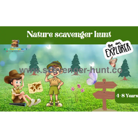
Designing Engaging Visual Elements
Map Aesthetics and Theme Integration
The visual design of your treasure map significantly impacts the participants' experience. Consider your hunt's theme when choosing colors, fonts, and imagery. A pirate-themed adventure might use weathered parchment backgrounds and compass roses, while a modern urban exploration could employ sleek, contemporary design elements.
Layer satellite imagery with artistic elements to create depth and interest. Semi-transparent overlays can add vintage effects without obscuring important geographical details. Custom icons and symbols help participants quickly identify different types of locations and clues.
Incorporating Multimedia Elements
Modern treasure maps can include QR codes linking to video clues, audio recordings, or additional digital content. Consider embedding short video messages from characters in your hunt's story, or include augmented reality elements that reveal additional information when viewed through smartphone cameras.
Photo documentation of actual locations helps participants verify they've found the correct spot, especially in areas with multiple similar landmarks. Before-and-after photos can be particularly useful for locations that change frequently due to construction or seasonal variations.
Clue Creation and Integration
Balancing Challenge and Accessibility
Effective treasure hunt clues challenge participants without creating insurmountable obstacles. Layer your clues with multiple difficulty levels – include obvious visual cues for quick identification alongside more subtle elements that reward careful observation and creative thinking.
Consider your audience's diverse skill sets and knowledge bases. A mix of physical observation, logic puzzles, historical references, and collaborative challenges ensures everyone can contribute to the team's success.
Location-Specific Clue Design
Tailor each clue to its specific location's unique characteristics. A clue at a historic building might reference architectural details or historical events, while a park location could incorporate natural landmarks or recreational facilities. This approach creates stronger connections between participants and their environment while making clues more memorable and meaningful.
Use multiple verification methods for each location – participants might need to find a specific landmark, answer a question about the location, take a photo with a particular view, or locate a hidden object or marker.
Technology Integration and Digital Enhancement
GPS Accuracy and Alternative Verification Methods
While GPS technology is remarkably accurate, urban canyons, dense tree cover, and tall buildings can interfere with precise location detection. Design backup verification methods that don't rely solely on GPS coordinates. Visual confirmation through photos, answers to location-specific questions, or discovery of physical markers provides redundancy and reduces frustration.
Consider creating location radii rather than exact coordinates – participants need to be within a reasonable distance of the target rather than standing on a precise spot.
Offline Accessibility and Backup Plans
Not all treasure hunt locations have reliable internet connectivity. Design your maps and clues to function offline whenever possible. Download offline map areas in advance, create PDF versions of digital maps, and ensure essential information remains accessible without constant internet access.
Prepare contingency plans for technology failures. Have paper backup maps, alternative communication methods, and simplified versions of digital clues ready for deployment if technical issues arise.
Group Management and Communication
Team Coordination and Safety Protocols
Establish clear communication protocols before beginning the hunt. Provide emergency contact information, establish check-in times for longer hunts, and create group messaging systems for real-time updates and assistance requests.
Consider appointing team leaders or providing communication devices for groups that might become separated. Walkie-talkies, group messaging apps, or designated phone trees help maintain coordination while preserving the adventure's independence.
Progress Tracking and Assistance Systems
Build progress monitoring into your treasure hunt design. QR codes or digital check-ins at each location allow organizers to track team progress and identify groups that might need assistance or encouragement.
Create hint systems for teams that become stuck at particular locations. Progressive hints that provide increasing levels of assistance help maintain forward momentum without giving away solutions entirely.
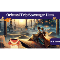
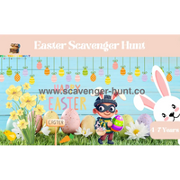
Customization for Different Audiences
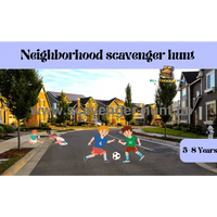
Age-Appropriate Adaptations
Tailor your treasure hunt's complexity, distance, and themes to match participants' ages and abilities. Children's hunts might focus on visual recognition and simple puzzles, while adult adventures can incorporate complex riddles, historical research, and multi-stage challenges.
Consider mixed-age groups by creating layered clues that offer different engagement levels for various participants. Simple surface elements keep younger participants involved while deeper puzzles challenge adults.
Educational Integration
Transform treasure hunts into learning experiences by incorporating educational content relevant to your locations. Historical sites can include period-appropriate challenges, nature areas might feature environmental education, and urban hunts could explore architecture, local culture, or community resources.
Balance education with entertainment – participants should learn organically through their adventure rather than feeling like they're completing homework assignments.
Advanced Features and Creative Enhancements
Augmented Reality and Interactive Elements
Emerging technologies like augmented reality (AR) can add magical elements to treasure hunts. AR apps can reveal virtual objects at real locations, provide historical overlays showing how areas looked in the past, or create interactive characters that guide participants through challenges.
These technologies work particularly well for indoor treasure hunts in museums, libraries, or educational institutions where digital infrastructure supports enhanced experiences.
Collaborative and Competitive Elements
Design hunts that encourage both collaboration and friendly competition. Teams might need to work together at certain locations while competing for speed or creativity at others. Point systems, bonus challenges, and multiple winning categories (fastest completion, most creative solutions, best teamwork) keep all participants engaged regardless of their competitive abilities.
Consider creating interconnected hunts where teams' actions at early locations influence later challenges, requiring communication and coordination between groups.
Logistical Considerations and Best Practices
Weather Contingencies and Seasonal Adaptations
Outdoor treasure hunts must account for weather variability and seasonal changes. Create indoor alternatives for severe weather, choose locations that remain accessible year-round, and prepare weather-appropriate materials and equipment.
Seasonal variations can actually enhance treasure hunts – spring flower locations, summer water features, autumn leaf collections, or winter snow sculptures add natural variety and encourage repeat participation throughout the year.
Legal and Permission Requirements
Research legal requirements for your treasure hunt locations. Public parks, historic sites, and private properties may have specific rules about organized activities, group sizes, or temporary installations. Obtain necessary permits and permissions well in advance, and respect posted rules and regulations.
Consider liability and insurance requirements, especially for larger groups or more adventurous activities. Clear waivers, safety briefings, and emergency procedures protect both organizers and participants.
Measuring Success and Gathering Feedback
Post-Hunt Evaluation and Improvement
Systematic feedback collection helps improve future treasure hunts. Survey participants about clue difficulty, map clarity, location accessibility, and overall enjoyment. Document technical issues, timing problems, and participant suggestions for future reference.
Photo and video documentation of the event provides valuable insights into participant behavior, engagement levels, and potential improvements. Time-lapse photography of popular locations can reveal traffic patterns and bottlenecks.
Building Community and Repeat Engagement
Successful treasure hunts often evolve into regular community events or ongoing series. Create social media groups for participants to share photos and experiences, establish regular hunt schedules, and develop themed series that build upon previous adventures.
Consider training experienced participants to become hunt creators, expanding your organizing capacity while maintaining fresh perspectives and creative approaches.
Conclusion
Creating digital treasure maps and scavenger hunts represents a perfect fusion of traditional adventure with modern technology. The tools and techniques available today allow organizers to create professional, engaging, and memorable experiences that can be adapted for any audience, location, or theme.
The key to successful treasure hunt creation lies in balancing technological capabilities with fundamental adventure principles – clear objectives, appropriate challenges, safety considerations, and genuine fun. Whether you're organizing a children's birthday party, a team-building exercise, a community event, or simply looking to explore your local area in a new way, digital mapping tools provide the foundation for countless hours of adventure and discovery.
Start small with simple local hunts, experiment with different tools and techniques, and gradually expand your ambitions as you gain experience and confidence. The world is full of hidden treasures waiting to be discovered – you just need to create the maps that will lead adventurers to find them.